Brough Pier sits on the far north coast of mainland Scotland, just outside the village of Brough. It’s a small, working pier with a long history behind it, and while it’s easy to pass by, it’s worth slowing down for if you’re exploring this stretch of Caithness.
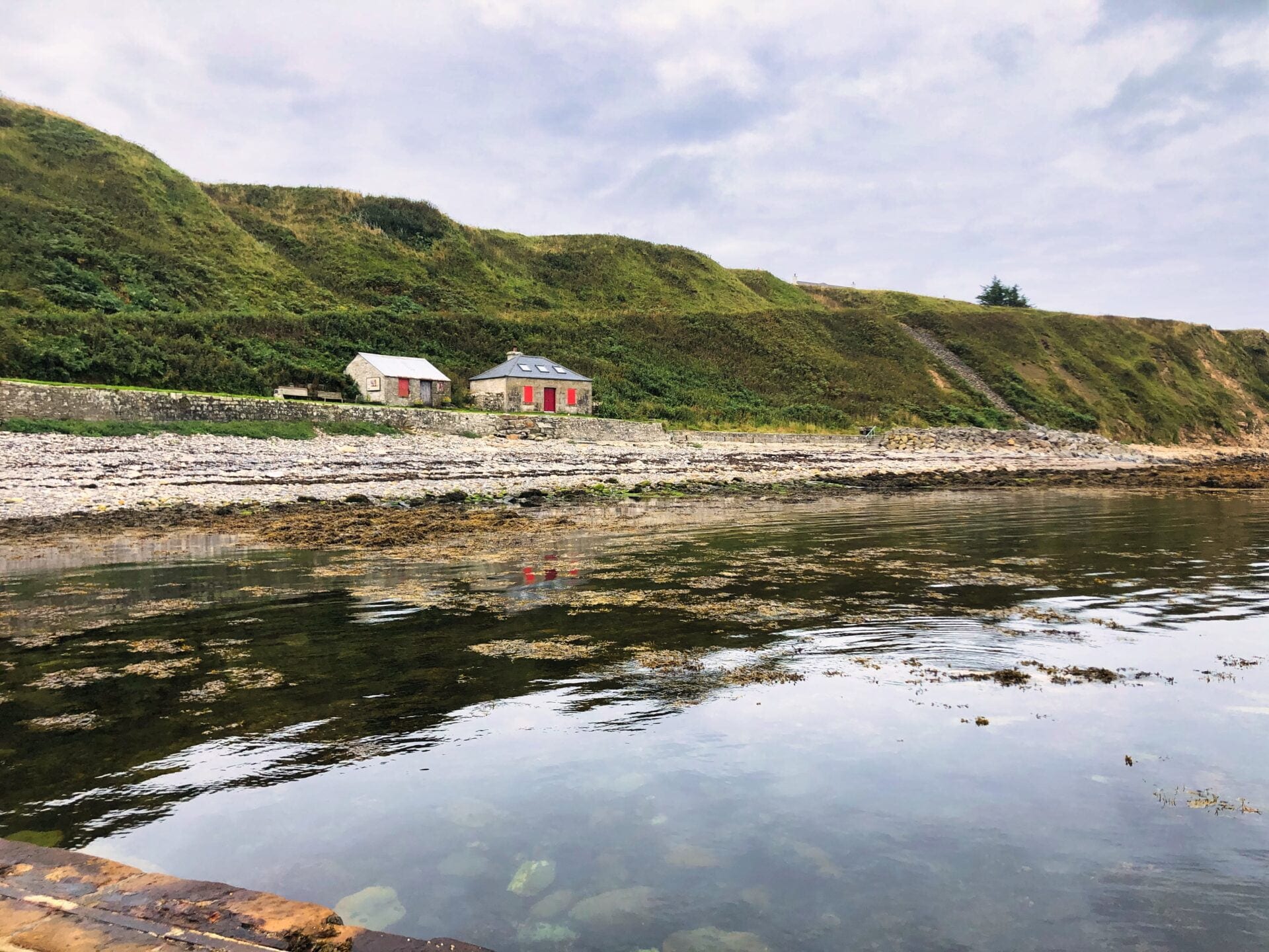
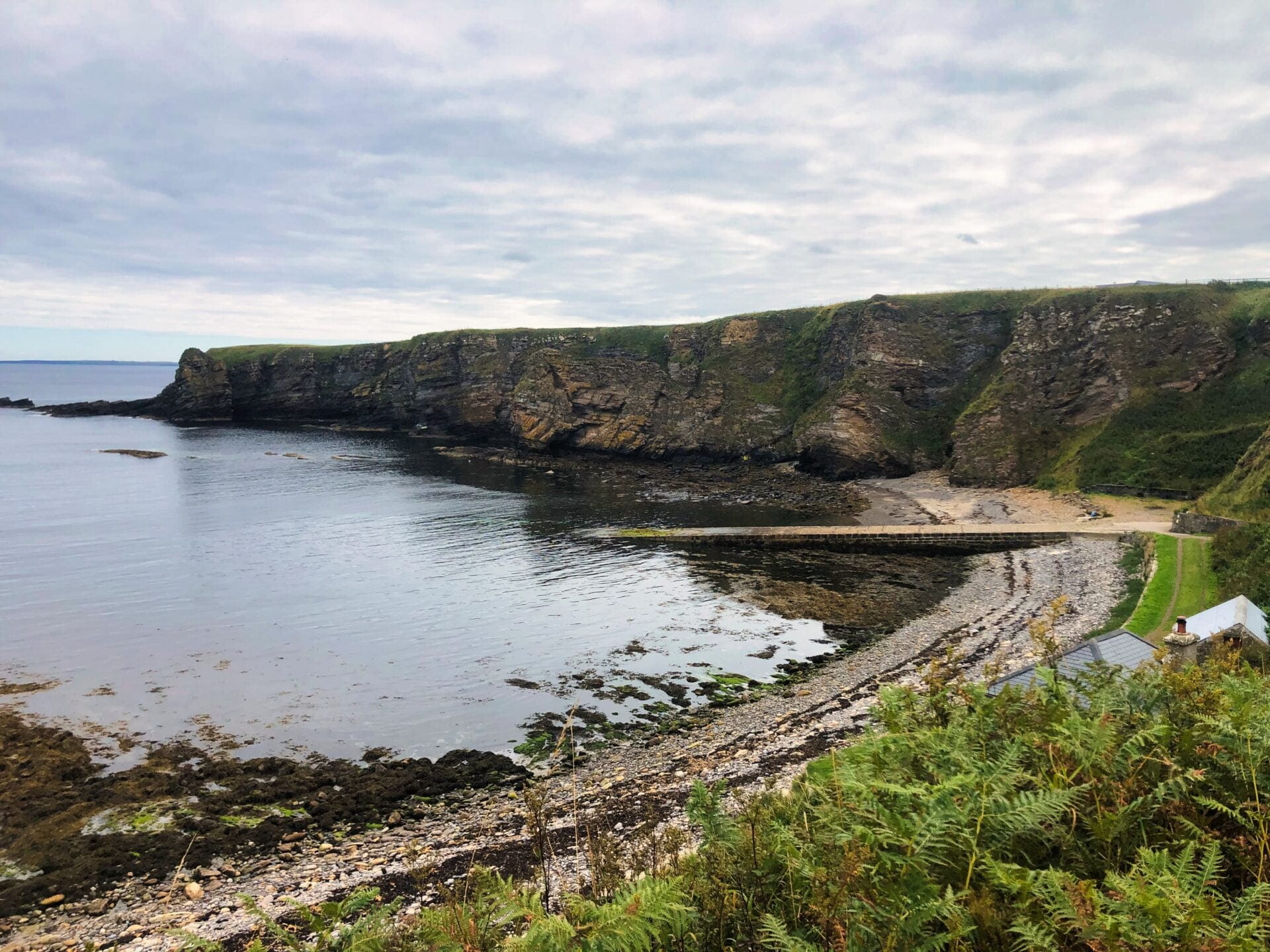
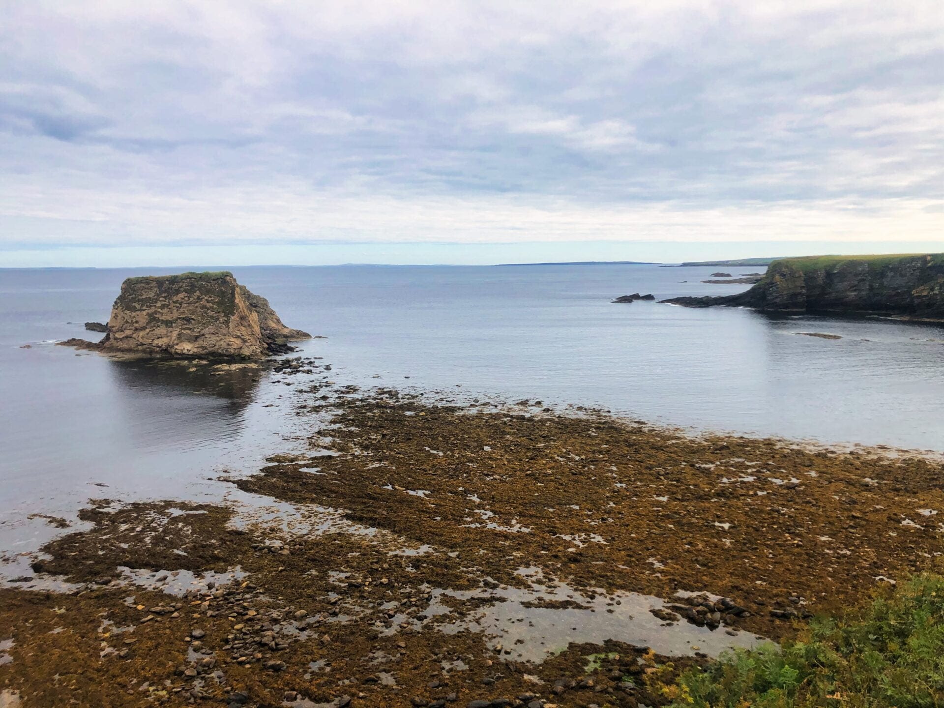
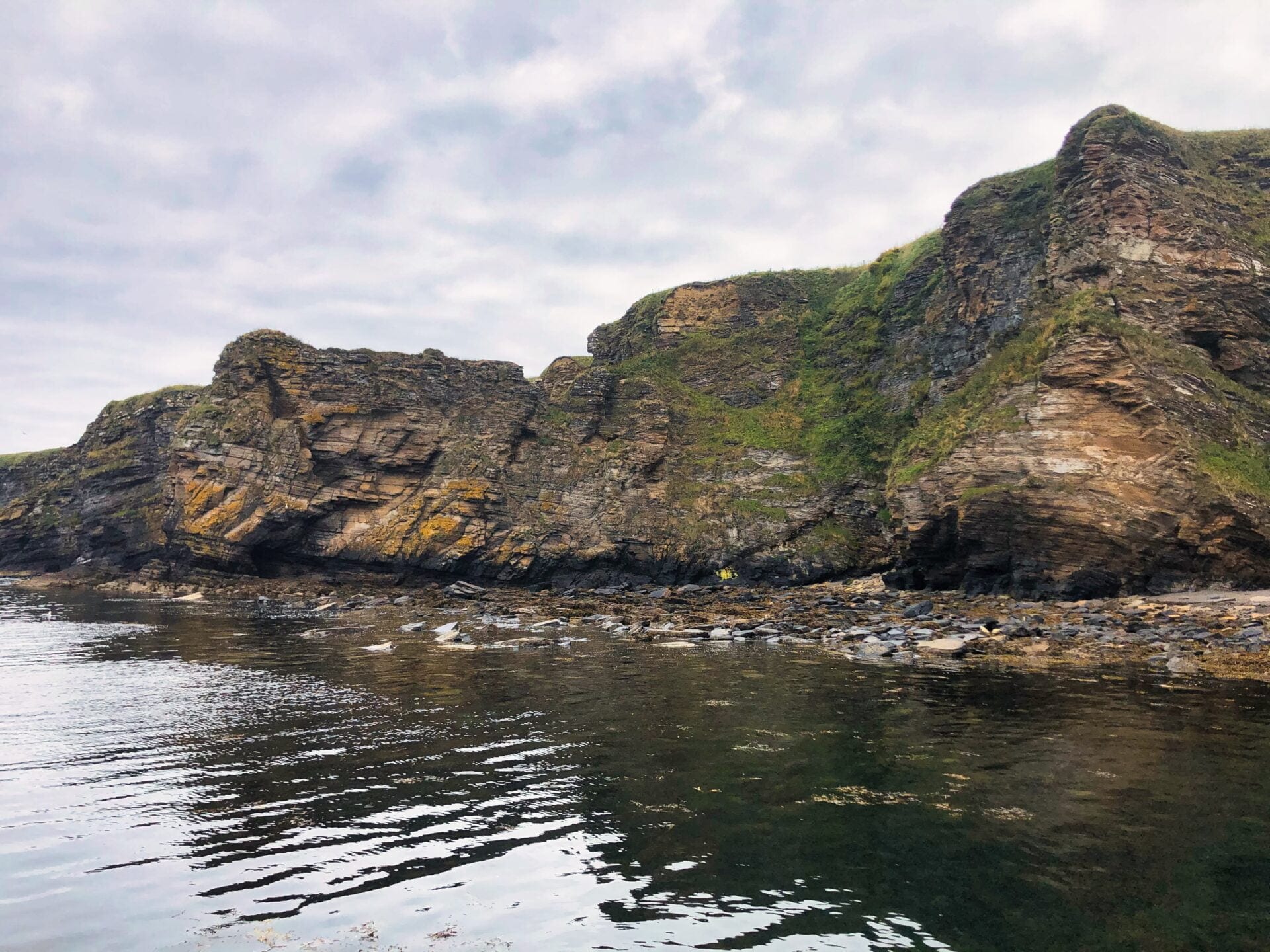
Located at 58° 39’N, 03° 20’W, the pier is privately owned by the Brough Bay Association and still functions as a small craft landing point. It dates back to 1794 and is partially sheltered by offshore reefs, which give it a bit of protection from the open Pentland Firth.
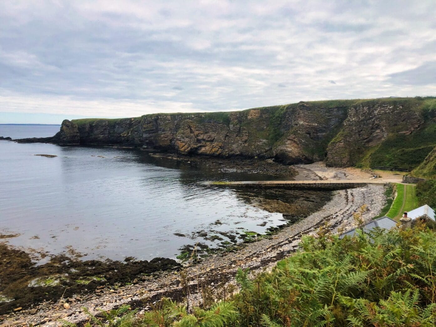
One of the more distinctive features here is the stone slipway and store building. These were constructed in 1830 by the Northern Lighthouse Board during the build of Dunnet Head Lighthouse, designed by Robert Stevenson. Even now, you can see how the pier would have supported that work, with solid, practical construction built to last in a tough coastal environment.
Getting to Brough Pier
Brough Pier is reached via the village of Brough, the most northerly village on mainland Scotland. It sits just west of Dunnet Head, which marks the northernmost point.
Most people arrive via the B855 from Dunnet, or by following the coastal road from Skarfskerry if you’re coming from the direction of John O’ Groats. The roads are typical for this part of the north coast, narrow in places but straightforward if you take your time.
Once in the village, the pier is close by and easy to find, though it feels slightly tucked away from the main through route.
Parking at Brough Pier
Parking around Brough Pier is limited and fairly informal. There isn’t a clearly defined public car park at the pier itself, and space within the village is tight.
There is some turning space near the slipway, which has historically been used by harbour users and visitors, but it still feels like a shared working area rather than somewhere set up for visitors.
In the village, parking options are minimal. There’s no reliable roadside parking area, and places like the café are not intended for general use unless you’re a customer. If you’re arriving in a larger vehicle, it helps to approach slowly and be prepared to turn around rather than assuming there will be space available.
Access and Ownership
Brough Pier is privately owned and maintained by the Brough Bay Association, a local community group that looks after the harbour and its infrastructure.
Access is generally informal rather than restricted. There are no formal entry points or controlled access, and most people visit without issue as long as they’re respectful of the space.
It’s still a working harbour, used by local boats, so it’s best approached with that in mind. There’s no separation between visitor space and working space, which makes awareness and positioning more important than anything else.
Signage and Restrictions
Signage around Brough Pier is limited, and there’s little in the way of formal visitor guidance once you arrive. You won’t find marked parking areas or structured information boards.
There aren’t widely documented restrictions, but the private ownership and working nature of the harbour mean visitors are expected to use the space considerately. Keeping clear of the slipway and leaving room for any harbour activity goes a long way.
In practice, it’s a straightforward place to visit as long as you keep things low impact and treat it as a functional coastal space rather than a managed attraction.
What’s Around Brough
The wider area around Brough is full of small historical sites and coastal stops that are easy to link together into a slow day of exploring.
There are several brochs nearby, including Carn Liath Broch and Nybster Broch, along with the remains of Castle Sinclair Girnigoe further down the coast. These sites give a sense of how long this coastline has been occupied and defended.
For beaches, you’ve got options in both directions. Keiss Beach, Sandside Beach, Peedie Sands Beach, and the wide stretch of Dunnet Bay all sit within a short drive. Each has a slightly different feel, from open sand to more rugged shoreline.
Other stops nearby include the Whaligoe Steps, which drop steeply down to a natural harbour, and the quieter walks around Loch More. The Laidhay Croft Museum offers a look at traditional Highland life if you want some context to the landscape you’re travelling through.
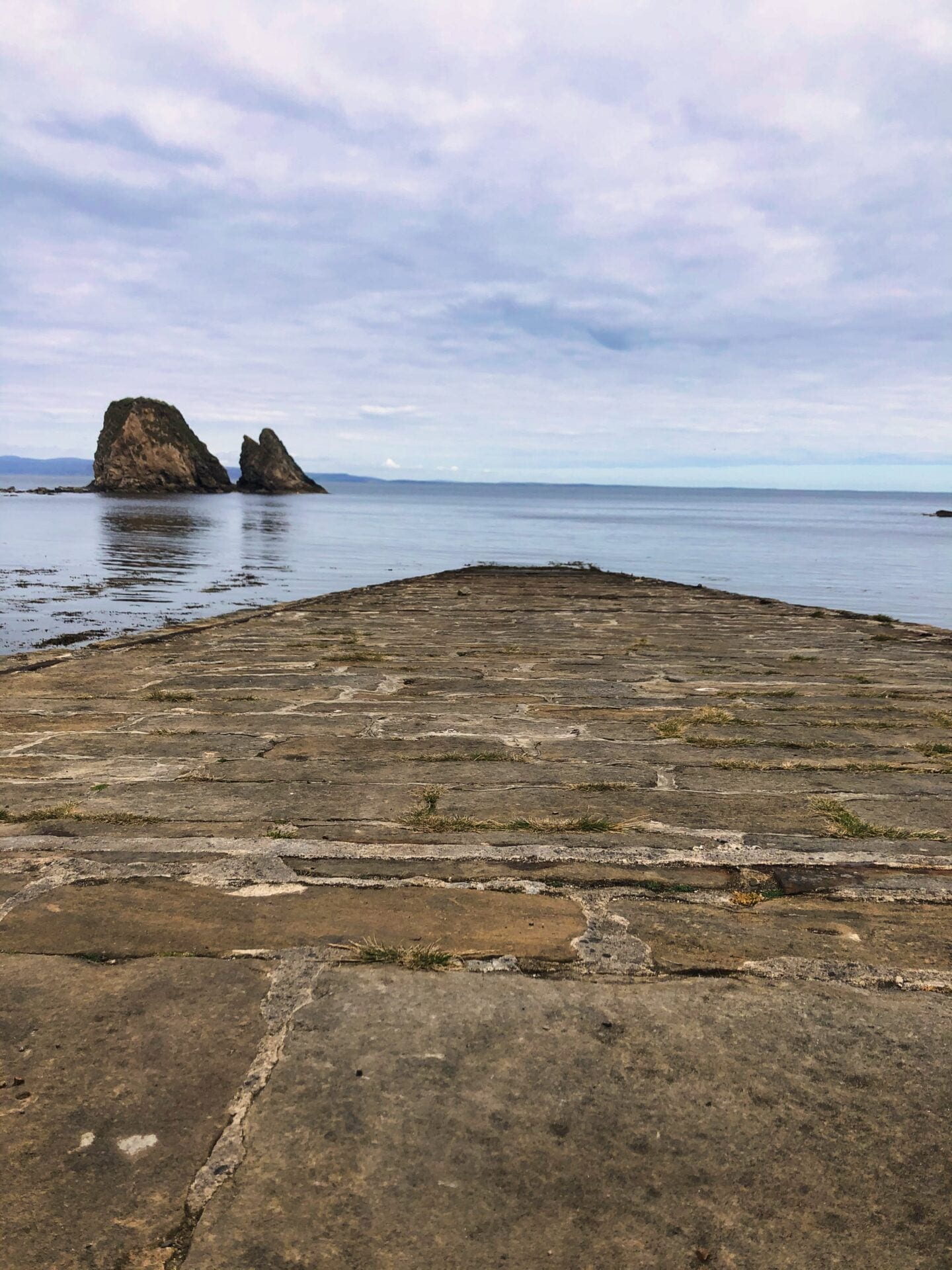
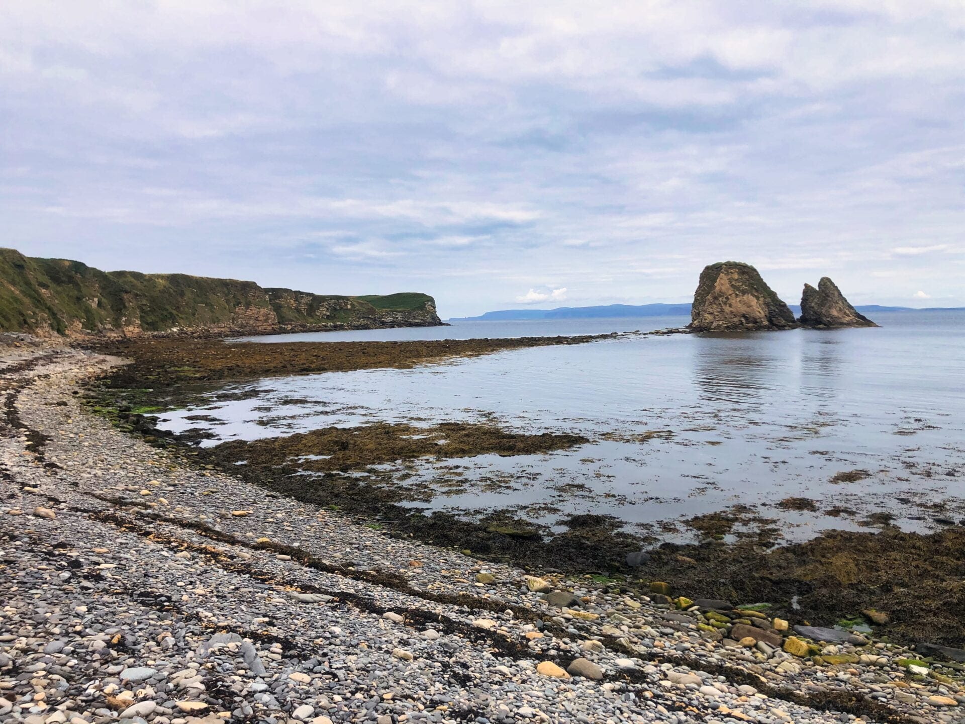
Back in Brough itself, there are open views across the coast towards the rock stack known as Little Clett. It’s a reliable place to spot seals in the water and seabirds along the cliffs, especially if you spend a bit of time watching rather than just passing through.
Brough Castle and Local Walks
Just outside the village are the remains of Brough Castle, thought to date back to a 12th-century Norse fortress. There’s not much left in terms of structure, mostly low grassy mounds, but it gives an idea of how strategically important this stretch of coastline once was.
If you’re on foot, the walks around Yarrows Loch are one of the better ways to experience the area. The routes combine open landscape with archaeological sites, so you’re not just walking for the scenery.
Another worthwhile route heads towards Crosskirk and St Mary’s Chapel. It’s a quieter path, but it ties together coastal views with some of the area’s older religious sites.
Visiting Brough Pier
Brough Pier itself isn’t a large attraction, and that’s part of the appeal. It’s a simple, working place with a lot of history built into it, set against a coastline that still feels exposed and largely unchanged.
It works best as a short stop rather than a destination on its own. If you’re already heading towards Dunnet Head or travelling the north coast, it’s an easy detour that adds a bit of context to the area, both historically and geographically.
Give it a bit of time when you’re there. The details of the stonework, the shelter from the reefs, and the general feel of the place make more sense when you slow down and take it in properly.
Information
Address: Brough Pier, Brough, Thurso, Caithness, Scotland, KW14 8YA
Latitude: 58.6500
Longitude: -3.3333
What3Words: ///crinkled.force.unimpeded
Directions: Follow the B855 to Brough, then continue through the village towards the coast where the pier is located at the shoreline.
Note: The pier includes a stone-built slipway constructed in 1830.