
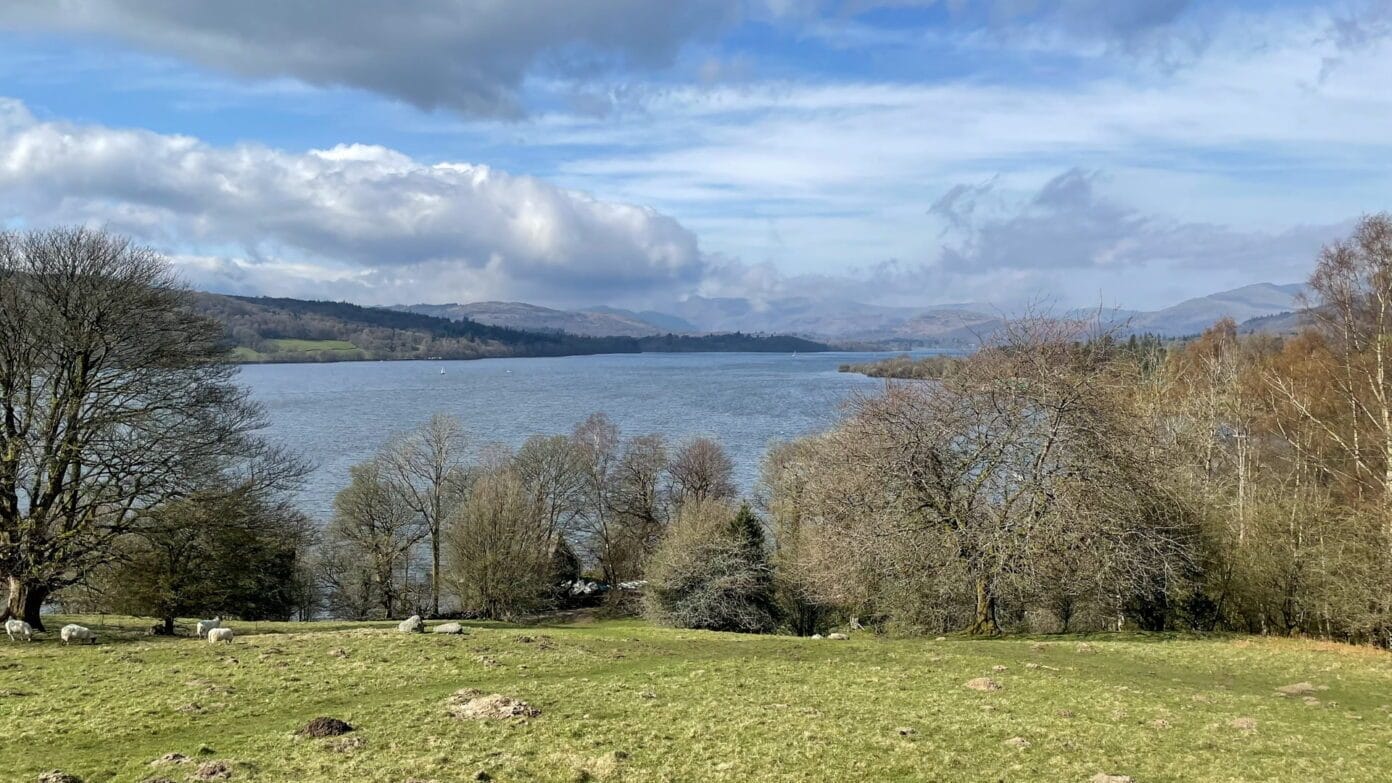
Queen Adelaide’s Hill sits just outside the town of Windermere in England’s Lake District. It is neither a long walk nor a demanding climb, but it offers a quiet viewpoint over the lake without taking up much of the day.
It suits visitors looking for a gentle walk, whether you are stopping during a road trip, exploring Windermere on foot or simply looking for somewhere to stretch your legs. For van and campervan travellers, it can also make a useful short stop between longer journeys, with the walk beginning close to the lakeshore.
Getting to Queen Adelaide’s Hill
From the A591, follow the signs into Windermere and continue down Rayrigg Road. A small car park beside Lake Windermere provides a practical starting point for the walk.
Drivers of vans and larger vehicles may want to approach slowly and allow a little extra time when arriving, particularly if the car park is busy. The original route does not require a remote or difficult road approach, but the parking area is described as small, so it may not suit every vehicle at peak times.
Windermere railway station is also nearby. From the station, you can take a short taxi ride or walk along Rayrigg Road to reach the base of the hill.
Starting at Rayrigg Meadow
Before climbing, it is worth pausing at Rayrigg Meadow. This open grassy area sits beside the lake and offers space to rest, have a drink or take in the view before heading uphill.
It also makes the walk easy to fit around the rest of your day. You can stop briefly for the viewpoint or spend longer by the water before continuing along one of the nearby paths.
The walk to the viewpoint
A clear footpath leads steadily up Queen Adelaide’s Hill. The climb is gentle rather than strenuous, and it does not take long to reach the viewing platform.
From the top, Lake Windermere stretches out below, framed by rolling hills and the more distant fells. This is not a high or dramatic summit. Its appeal is that you can gain an open view of the landscape without committing to a long climb.
Near the top is a memorial plaque dedicated to Queen Adelaide, consort of King William IV. She visited the area during the 19th century, and the hill was named in her honour. The plaque adds a brief point of local history before you return towards the lake.
Walking options from Queen Adelaide’s Hill
Short walk to the summit
The simplest option is a short loop from the car park to the viewpoint and back. At a steady pace, the walk often takes around half an hour. Allow longer if you plan to stop at the top or spend time beside the lake.
This option is best suited to visitors who want a brief walk rather than a full day on the trails. It can work well for couples, families and road-trippers looking for a manageable stop close to Windermere.
Windermere Shoreline Path
For a longer outing, the Windermere Shoreline Path begins here and follows the eastern edge of the lake. The route passes through woodland and more open sections, with regular glimpses of the water.
You can choose how far to follow the path rather than committing to a fixed route. A longer walk may take a couple of hours, depending on where you turn back and how often you stop.
Extending the walk to Orrest Head
Another option is to extend the walk towards Orrest Head. This adds more distance and a steadier climb, but rewards the extra effort with a broader view over Windermere and the surrounding fells.
It is a useful choice for walkers who want more than the short Queen Adelaide’s Hill loop while remaining close to Windermere.
Woodland and wildlife
Along the surrounding paths, the woodland feels noticeably quieter than the nearby town and road. Birdsong is often one of the first things you notice, particularly during spring and summer, when common Lake District birds can be seen among the trees.
There may also be signs of red squirrels deeper within the woodland, although sightings cannot be relied upon. Taking a slower pace gives you a better chance of noticing the smaller details around the path.
Is Queen Adelaide’s Hill worth visiting?
This part of the Lake District lies within a UNESCO World Heritage landscape, recognised for both its scenery and the long relationship between people and the land.
Queen Adelaide’s Hill is not one of the Lake District’s highest or best-known viewpoints, and visitors looking for a substantial fell walk will find it limited. Its strength is accessibility in the broader sense: it provides a short, straightforward way to rise above the lakeshore and understand the shape of the surrounding landscape.
Whether you stop for half an hour or use it as the beginning of a longer walk, it is a calm introduction to this side of Windermere. There is enough height for a rewarding view, while the town, lake and onward paths remain close at hand.
Address: Rayrigg Meadow, Windermere, Cumbria, United Kingdom
Latitude: 54.3789
Longitude: -2.9192
What3Words: replays.rosier.ethic
Directions: From Windermere town centre follow Rayrigg Road east and turn onto the minor road to Rayrigg Meadow car park; the hill summit is immediately above the car park to the north.
Note: The surface to the summit path is steep grass and gravel.